Sanyark Space: Building India’s Navigation Satellite Backbone
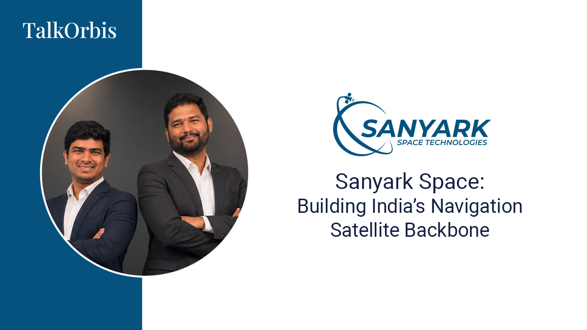
Raghava Kundrapu (Founder & CEO) and Akhileshwar Reddy Peseke (Co-founder)
Raghava Kundrapu is a former ISRO scientist & SpaceTech Consultant at Deloitte and now the Founder & CEO of Sanyark Space, a Hyderabad-based deep-tech startup. He co-founded in 2025 with fellow ISRO veteran Akhileshwar Reddy Peseke. Sanyark Space is building India's first integrated LEO NAV-COM satellite constellation, which delivers centimetre-level navigation and secure 5G-NTN communication to power a resilient, autonomous world.
SUMMARY
- ISRO pedigree: The founders bring 20+ years of combined ISRO experience. Raghava contributed to 40+ national missions, including PSLV, GSLV and human spaceflight. Akhileshwar spent 13+ years on NavIC and GNSS technologies. Both brings complementary skillsets spanning tech x business expertise.
- Building NAV-COM Satellite Constellation: To enable autonomous world and to solve the problem of precision, resilience and autonomy at scale, they are building LEO satellites constellation for precision navigation and communication (5G-NTN).
- Rapid execution: In under a year, Sanyark raised US $2 million from Avaana Capital, AUM Ventures, T-Hub Foundation and SIDBI, grew to a team of 30+, build in-house navigation satellite payload, antenna and signals from scratch and planning to carry-out maiden satellite launch by Q1 2027.
Both of you spent years working in India’s space ecosystem, including on major national programmes. What did you experience at ISRO that made you realise there was a problem in navigation and connectivity that needed to be solved differently?
We came to the problem from two different directions, but saw the same gap. At ISRO, I worked on launch vehicles across 40+ missions, developing a systems and first-principles mindset. Akhileshwar spent over 13 years in India’s navigation programme, working on NavIC receivers, signal design, interference mitigation and GNSS tolling, where he saw the limitations of systems operating 20,000–36,000 km away.
The gap became clearer when I joined Deloitte as a spacetech consultant and worked on India’s next-generation space technology needs. GNSS tolling highlighted a key limitation: metre-level accuracy cannot reliably distinguish between a flyover, service road and main carriageway, while autonomous vehicles, drones and defence systems need centimetre-level precision with resilience against jamming and spoofing.
We also saw that navigation and connectivity were being built separately, even though modern applications need both. NavIC provides a strong sovereign foundation, but what was missing was a next-generation LEO layer combining precision, resilience and communication.
Today we largely take GPS and other satellite navigation systems for granted. What breaks when traditional positioning signals become unavailable, unreliable, or deliberately disrupted and why is that becoming a bigger problem for autonomous systems?
The problem goes far beyond navigation. Satellite signals also provide the precise timing that synchronises 5G networks, power grids, banking systems and stock exchanges. When those signals fail, aircraft lose positioning, ships drift off course, telecom networks lose synchronisation and financial systems lose accurate timestamps. The vulnerability lies in the physics: GNSS signals travel tens of thousands of kilometres and reach Earth extremely weak, making them easy to jam or spoof.
For autonomous cars, drones and defence systems, it can be dangerous. A machine cannot simply ask for directions—and if a signal is spoofed, it may confidently move in the wrong direction. As billions of autonomous machines emerge, navigation becomes safety-critical infrastructure where accuracy, resilience and integrity matter equally.
“For humans, losing GPS is an inconvenience. For autonomous machines, it is an operational failure. As billions of machines become autonomous, navigation becomes critical infrastructure. At Sanyark Space, we are building the infrastructure for precision, resilience and autonomy at scale.”
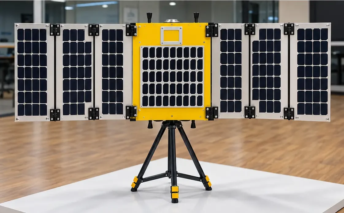
Sanyark is building a unified LEO platform that combines precise positioning, navigation and communication. Why did you believe these capabilities needed to come together instead of being built as separate systems?
Navigation and connectivity have never been truly separate for the applications that depend on them. Autonomous vehicles need precise positioning and communication with other vehicles and infrastructure; drones need navigation and command links; ships need positioning and tracking. Navigation and communication are increasingly integrated at the chip level, while standards such as 3GPP Non-Terrestrial Networks and the move toward 6G are bringing positioning and communication closer together.
The architecture also supports this convergence. Both rely on precise timing, RF hardware and onboard computing, making an integrated satellite system technically and economically efficient. Users get one service instead of separate devices and subscriptions, while operators can generate multiple revenue streams from each satellite.
You describe Sanyark as building the “space backbone for autonomous systems.” What changes when autonomous cars, drones, robots, defence platforms and other machines can access centimetre-level positioning and reliable connectivity from the same infrastructure?
The difference between metre-level and centimetre-level accuracy is the difference between a navigation aid and an autonomy-grade system. At metre level, a car knows which road it is on; at centimetre level, it knows which lane it is in. This precision unlocks new capabilities across industries. Autonomous vehicles can navigate reliably in poor visibility, while satellite-based tolling can become accurate and barrier-free. Drones can deliver precisely, inspect infrastructure autonomously and operate beyond visual line of sight.
For defence and critical infrastructure, resilient positioning, communication and timing reduce dependence on vulnerable or foreign systems. Most importantly, when vehicles, drones and robots can determine and share their exact position reliably, they can coordinate with each other. That is the foundation of a truly autonomous world—and the backbone Sanyark is building.
India has a particularly complex environment for navigation — dense cities, rural areas, changing infrastructure and diverse terrain. How are these real-world conditions influencing the way you design Sanyark’s technology?
India is one of the world’s most challenging navigation environments, which is why we are designing for it first. If it works in India, it can work anywhere. In dense cities, tall buildings, flyovers and narrow streets create urban canyons that disrupt GNSS signals. LEO satellites provide signals roughly 100 times stronger than conventional GNSS, improving performance in urban and indoor environments while their faster movement enables quicker, more accurate positioning.
In rural and border regions, where terrestrial networks can be limited, communication is built directly into our satellites. Vehicles, farms and vessels can stay connected while being precisely located without relying on mobile towers. We have also designed for India’s cost-sensitive market by making our signals compatible with existing commercial GNSS receivers and aligning with 3GPP standards, reducing the need for proprietary hardware.
Moving from working inside a large national space organisation to building a young deep-tech startup is a very different experience. What has been the biggest adjustment for you personally and what did you underestimate when you started?
At ISRO, you have decades of institutional experience, established processes and national support. In a startup, there is no system—you have to build it yourself. The biggest shift was moving from depth to breadth. At ISRO, I could focus on engineering; as a founder, I move between satellite architecture, investors, hiring, vendors and regulations, often making decisions with incomplete information. I left ISRO in the same month my child was born and started Sanyark three years earlier than planned, driven by the conviction that India needed this technology now.
I underestimated how much of the challenge would be non-technical. Engineering was familiar territory, but building a team, raising capital for a long-gestation hardware business and educating customers and policymakers required equal effort. The ecosystem support from T-Hub, IN-SPACe, investors and mentors helped us move from an idea to a 30+ person team and a satellite build in about a year.
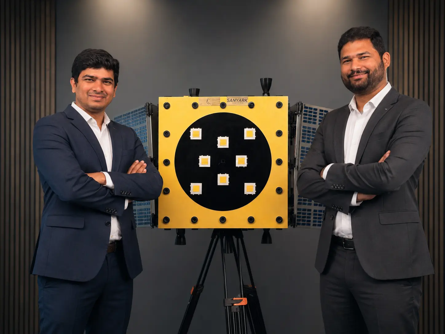
Your team has deep experience with NavIC and satellite navigation systems. How does Sanyark’s technology complement existing systems such as NavIC rather than simply trying to replace them?
We see NavIC as a crucial sovereign foundation, not something to replace. My co-founder Akhileshwar spent over 13 years working on NavIC receivers, signal systems, standards and next-generation PNT studies. The two systems serve different strengths. NavIC provides stable regional coverage from higher orbits, while LEO satellites offer stronger signals, higher precision, faster fixes and greater resilience against jamming. Together, they create a multi-layer PNT ecosystem.
NavIC and GNSS provide broad reference coverage, while Sanyark’s LEO layer adds centimetre-level precision, resilience and integrated communication. If one layer is degraded or jammed, others can continue operating—critical for infrastructure and autonomous systems. Interoperability is central to our design. Our signals are intended to work with existing NavIC and GNSS receivers, reducing the need for new hardware. We believe the future is not one system replacing another, but multiple systems working together—extending India’s sovereign navigation capabilities into precision, resilience and global connectivity.
Sanyark’s roadmap moves from early in-orbit proof-of-concept work toward a multi-satellite commercial constellation. What are the most important technical milestones you need to prove before this becomes a dependable real-world service?
We have a clear sequence of milestones, with each step reducing risk for the next.
- Prove precision from orbit: Our first mission, Dhrona-1, planned for Q1 2027 with SpaceX, will validate our proprietary PNT signals and payload in space. We have already demonstrated lane-level accuracy in automotive trials.
- Prove timing in space: Dhrona-1 will test chip-scale atomic clocks and our hybrid synchronisation approach, demonstrating the timing stability needed for an economical constellation.
- Prove interoperability: We will demonstrate that commercial GNSS receivers can use our signals alongside NavIC and other constellations without requiring new hardware.
- Demonstrate integrated NAV-COM: Our second mission, planned for Q4 2027, will combine navigation and direct-to-device communication from a single satellite, aligned with 3GPP NTN standards.
- Scale to a constellation: We aim to build continuous coverage and scale manufacturing to around 20 satellites a year, targeting a 40-satellite regional constellation covering India, South Asia and the Middle East by 2030.
Each milestone builds confidence with customers, partners and investors. In this industry, dependability is earned in orbit—one mission at a time.
“The future is a network of systems working together. India has the opportunity to build the next LEO layer for precision navigation and communication—the backbone of our connected world.”
Navigation and communications are increasingly being viewed as strategic infrastructure. What does it mean to you to build this capability from India, and where do you see India having an opportunity to become a global player rather than simply a user of foreign infrastructure?
Personally, this mission is deeply meaningful. My education was made possible through government scholarships, so building sovereign infrastructure for the country that invested in me feels like both a responsibility and an opportunity. What drives me most is the socio-economic impact these technologies can create.
Strategically, positioning and timing now underpin defence, aviation, telecom, power and finance. Yet India remains dependent on foreign constellations that can be degraded, denied or manipulated during conflicts. NavIC was a vital step; the next is a resilient, high-precision layer built by Indian industry.
LEO-based navigation and integrated NAV-COM are still emerging globally, giving India an opportunity to lead rather than catch up. With proven space engineering, a strong talent pool, launch capabilities and a large domestic market, India has the foundation to serve not only Bharat but also regions seeking trusted, resilient navigation.
Our guiding idea is simple: Build for Bharat, Bharat for Global.
If Sanyark succeeds in building the infrastructure you envision, what does the world look like five to ten years from now that is difficult or impossible today?
In five to ten years, I hope precise, reliable positioning becomes as invisible and dependable as electricity—it simply works, everywhere. Autonomous vehicles will know their exact lane in any weather, drones will deliver and inspect infrastructure beyond mobile coverage, and farmers will use centimetre-level precision to reduce water, fertiliser and fuel. Emergency responders will locate people accurately even when ground networks fail, while aviation, maritime and defence systems operate through resilient, secure navigation layers.
India’s telecom networks, power grids and financial systems will rely on sovereign, trustworthy timing. Most importantly, billions of cars, drones, robots and sensors will coordinate in real time because they share a precise understanding of where they are. If Sanyark succeeds, that invisible backbone will be built from India and serve the world.
Trending Interviews










Trending Interviews
Related Popular Interviews
-
 By Prerna Saini | October 09, 2026
Saubha Aerial Systems – Building Safety Layer for Autonomous Airspace
Read More -
 By Prerna Saini | October 02, 2026
From Voice Agents to Voice-First Hardware:The Story Behind Antimattr
Read More